Written and published by Linden Alexander Pentecost, published on the 28th of February 2026. This article/blog post is unrelated to, and separate from any and all of my other publications. No AI was used. This article was published in the UK, and I the author am from the UK and live in the UK. This article was only published on this website in front of you, which is not my only website. This article contains a total of 1378 words and 6 photos, the photos, like the rest of the article, have not been published until being in this article. I, the author, also took the photos for this article, and the photos, and the texts in italics above each photo, contain information not in the main text. Tomorrow I will be publishing an unrelated article about the Brennholtet Petroglyph in Narvik, Norway, which will be published on a different website to the website that this article/blog post on this page is published on here.
I have mentioned already the Cotestones or Cote Stones in another blog post on this website. Since writing the aforementioned blog post, I have managed to find the photos that I took of the Cotestones. The Cotestones consists of a group of large megaliths, lying partially submerged in an area of saltmarsh close to Carnforth and Warton in Lancashire, Northern England. I am unsure whether or not these stones are arranged naturally, or if they could be a part of a megalithic complex, but I think that the latter possibility may be the case. Furthermore, slightly inland from the saltmarsh, there is a bank, and some there are some stones below this bank, some of which are quite large, others of which look as if they form a part of a wall or even a cairn or barrow, similar to that at Ings Point, although the railway line is closeby and I am unsure to what extent this cairn-like feature could have been caused by the construction of the railway, although it is also possible that this was a cairn which was cut into or partially destroyed by the railway line. Note that I am not speaking of walking on the railway line itself, which is illegal and dangerous - all of the sites I mention are off railway property and can be accessed by walking along the shore, even if it is muddy in places.
Not far from this site are some of the other megalithic sites below and near Warton Crag, some of which I have discussed in other blog posts on this website, and I have discussed others elsewhere. Also nearby is Hunting Hill, a known megalithic site. It has been my supposition that Hunting Hill was active when sea levels were higher, and when Hunting Hill would have been an island. But if the Cotestones is also a megalithic site, it must have been created when sea levels were lower, because as I have mentioned, the Cotestones themselves are partially submerged in the saltmarsh. The name Cotestones is also curious, as "cote" refers to a kind of sanctuary to keep animals safe. If this refers to birds, then okay, perhaps birds were known to land on these stones and to make a home there, but if it refers to a shelter area for other animals, this simply cannot have been the case at present day sea levels. As with many other sites, I encourage my readers to visit the site themselves too and to make their own suggestions about its nature, but this article/blog post will be a good starting point, and for all I know could be the only thing ever written about this site in detail. Like many other sites, as far as I know, I am the only one who is aware of it as a potential megalithic site. Hopefully when others read this, it will encourage more interest. As with other potentially ancient sites, please treat this place with respect and reverence, and take care when walking on this coastline, remember that fast rising tides and quicksands are a genuinely real danger in Morecambe Bay. Cotestones also lends its name to a nearby farm, of which more is written about. Each of the photos below has a description above it written in italics, the descriptions will provide detailed information about what is present in different parts of the site, and that which is in the photos, and the photos themselves are also important for demonstrating this site.
Photo below: one of the Cotestones partially submerged in a saltmarsh pool, the markings on the surface of the rock are likely of natural origin, but it is still possible that the natural markings were significant in some way.
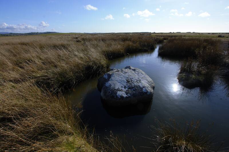
Photo below: another of the Cotestones. The surface of this rock has what look like cup markings in this image, but I do not personally think that they are cup markings. I would have to go back and check, but I am pretty sure that the markings on the surface of the stone in the photo below result from erosion. Having said this, Hunting Hill nearby does have some possible cup-marked stones, and there are also some possible cup marks on Warton Crag itself, close to the highest point on the crag. The stone in the photo below has what looks like several cup marks going vertically down the stone from the angle of the photo, with one possible cup mark at the top of the stone, and two in a line going down from there, but this is speculation, and for the moment I will assume that these are not cup marks.
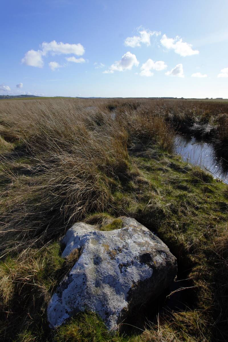
Photo below: another of the Cotestones, this one has erosion markings typical of those found on the local limestone, and has no suggestion of cup markings. Note also how this stone sits in the water and mud of the saltmarsh, presumably supported by a more solid substrate or by bedrock beneath.
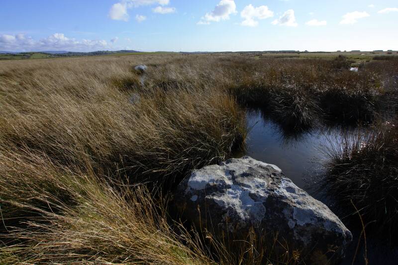
Photo below: another of the Cotestones, sat in a saltmarsh pool. This one has a shape somewhat akin to that of a crocodile head (in my opinion), although, there are no crocodiles around Carnforth, to my knowledge.
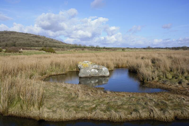
Photo below: the line of stones close to the shore, which looks as though it could be part of a cairn or barrow (long barrow), but the structure could of course be later, although given the presence of other megaliths nearby, I think there is a fair possibility that this line of stones is old.
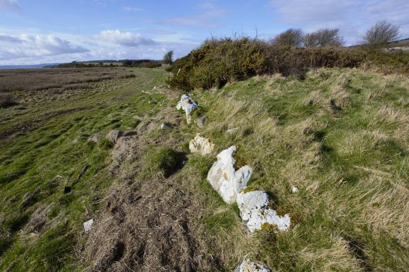
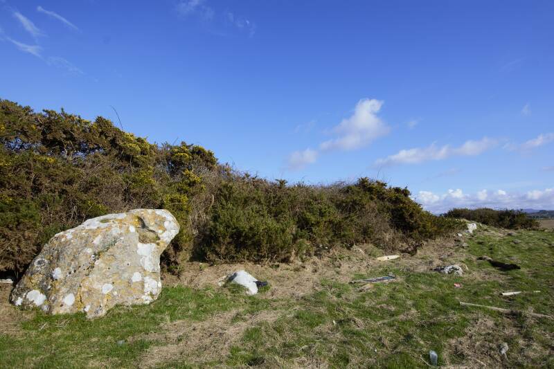
Photo below: a large megalith on the shore close to where the possible cairn or long barrow is located. To me, this megalith in the photo below somewhat resembles a toad, but could also be interpreted as a bowing human figure, or as the beak and head of a giant bird. It appears to be "facing" towards the possible cairn/long barrow, some of the stones of which can just be seen towards the right of the image below. Note that the possible shaped stone in the photo below is unrelated to any of the stones discussed in my unrelated article/blog post published very recently on this website, titled: "On four other ancient stones in the Morecambe Bay area, which resemble ancestor spirit beings, published on the 26/02/2026". It is also noteworthy I think that there is a smaller stone of a shape very similar to that shown in the photo below, which is located nearby on Hunting Hill.
I hope that this article was an interesting read, and that it has helped to provide some interesting information about this site. This article is, paradoxically, dedicated to Scotland and to my grandad, Scotland because I am really missing Scotland right now, specifically the Western Isles, not Edinburgh or anything like that. My grandad is also connected to Carnforth, though. Tomorrow I will be publishing an unrelated article on my newest website (not the website you are currently on), the aforementioned new article will concern the Brennholtet petroglyph in Narvik, Northern Norway, and will be unrelated to this article in front of you, on this page.
Add comment
Comments