This blog post was written and published by Linden Alexander Pentecost, and was published on the 18th of November 2026, early in the morning, and was published in the UK. No AI was used, and the four photos were also taken by myself, the author. This blog post is unrelated to and separate from any and all of my other publications, and it contains 1375 words. This blog post was published earlier in the morning and was published earlier in the morning in the UK.
This site is one of Cumbria's other seemingly infinite number of potential archaeological sites which have escaped notice. This site is located just above and to the east of the lower part of the Duddon Valley, although when I say "lower" in this context I mean of the river valley, and not including the large estuarine area bordered by moors and mountains, such as Black Combe to the north and Kirkby Moor to the south. The location is the site I discuss in this blog post is around the coordinates of: 54.305987, -3.224256 , and can be accessed by following a trackway upward from a farm, the bottom of this trackway where it meets the road is at the coordinates: 54.302973, -3.228199 . Unfortunately it was several years ago when I visited this site and so I cannot pinpoint the exact coordinates of all the features, but I will say that the site contains typical examples of Cumbrian megalithic architecture, including Bronze Age-looking cairns, possible arrangements of large boulders, an embankment of packed stones and associated ditch, and a propped stone with one of the stones having a typical elongated skull shape. I will give this site the name of "The Stonescar - Black Stones possible megalithic area", and I am including both the names Stonescar and Black Stones because I am not sure exactly which of these place names - from a map, best applies to the area in question, although it is possible that some of the megaliths or large boulders I saw there are the "Black Stones", a place-names, which, might simply be a Middle English layer of language application to describing the megaliths, or it could imply more significance to these stones. I am not sure. I do not know of any place-names in the area connected to the Crane Men, but this is something I will look into.
Note that I wrote an unrelated blog post on this site with more about the Crane Men. In this area is a hill called Great Stickle, not to be confused with Stickle Pike, also nearby, and with Pike O' Stickle in Langdale, both of which I have written about extensively. I suspect that Great Stickle will have megalithic sites too, and the name "Stickle" is significant here. I have discussed it elsewhere, how it seems to relate, if we trace it back in a truly ancient sense - to a root *stik- connected to stickiness, being something solid, like a stick, whilst the -kVl part at the end is also found for example in "icicle" being apparently an Indo-European root for "ice", but arguably also connected to ancient root words meaning "hard", "solid", as in the *kVl- pattern in the Welsh word caled - "hard". In Middle English "stykyl", giving Modern English "stickle" means something pointy. Often I find for some reason that Middle English is helpful in understanding the place-names of the Duddon and perhaps this language sphere relates to the period when the valley was "re-colonised". Stickle Pike and Pike O' Stickle both show interesting geometry and contain rocks that "ring" when you knock them together. Both are clearly very spiritual sites and at some point I will check out Great Stickle to see if the geology there matches. In Kozyrevian science these sites imply very special "antenna" points of transmitting earth energy into the sky, and according to what I have been told, in some cultures these "ringing rocks" were used to open portals to the realm of the gods, and should, in essence, not be "rung", especially not on these mountains, where the time energy is so concentrated at a particular point. I have previously discussed also the "bell" or "dome" shape of Pike O' Stickle and how the ringing rocks and "Axe Factory" pertain to altering electrical currents (see the mythology about axe stones, flints and lightning), and to how this may connect to the Brythonic mythological theme of a secret cavern under a mountain, with a bell inside, and how "ringing" said bell wakes up Arthur's sleeping warriors. I had not previously connected this to how "ringing rocks" are said to open portals in other cultures, and nor had I connected it to Kozyrevian physics before now, per-se.
Sometimes in Cumbria it is not always the most upland mountainous areas which contain the most megalithic mysteries, it is as much these rockier, more low-key, but less mountainous areas within the landscapes that border the mountains proper. Another site I will briefly mention, at Cunswick Tarn for example, is also not known to my knowledge, and there are of course countless others. The Duddon Valley area seems particular big on these elongated-head shaped rocks, and I wonder if this in some way connects to the giants' graves megalithic monuments in this valley, and to the legends of the giant Crane Men who once walked these mountains.
There is an iron works located on near Cinder Hill, slightly to the north of this site, but the iron mines in this area were small, and I did not see any evidence of iron mining at the site I discuss in this blog post. Note also that roughly opposite this site to the west is the place-name Penngennet (not the same Penngennet I discuss that exists in Kentmere, which I discussed in an unrelated recent blog post). This name Penngennet does of course relate to the more ancient cultures of this valley, as I have discussed elsewhere.
This site will be described in even more detail in the photo descriptions above the following photos:
Photo below: dyke-like feature with partially-stone built embankments on either side, this could be medieval or even more recent but I think it entirely possible that it could equally be of iron age or prehistoric origin. Furthermore I am aware of no mining sites in this particular area.
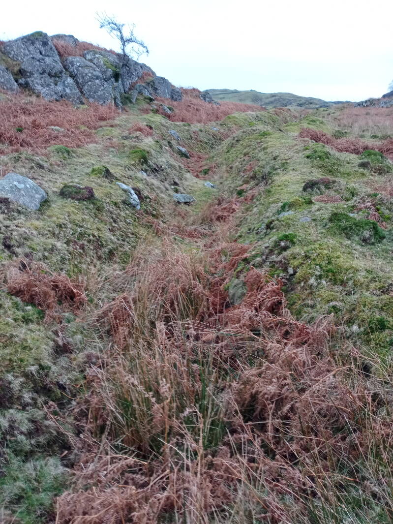
Photo below: a possibly-unnaturally-arranged group of large boulders or megaliths at this site, there are several others in this area, not included in these pictures, which do indeed seem to have alignments of some kind, although how "natural" their placements are is of course up to debate.
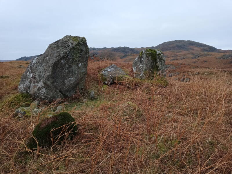
Photo below: a possible, if not likely, prehistoric cairn at this site, which can be seen in the foreground from the left towards the centre of the image, taking up a large area of the image. The round shape of the central "wall" of the cairn can be seen in relation to the hollow centre.
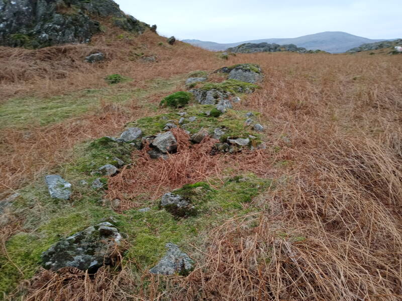
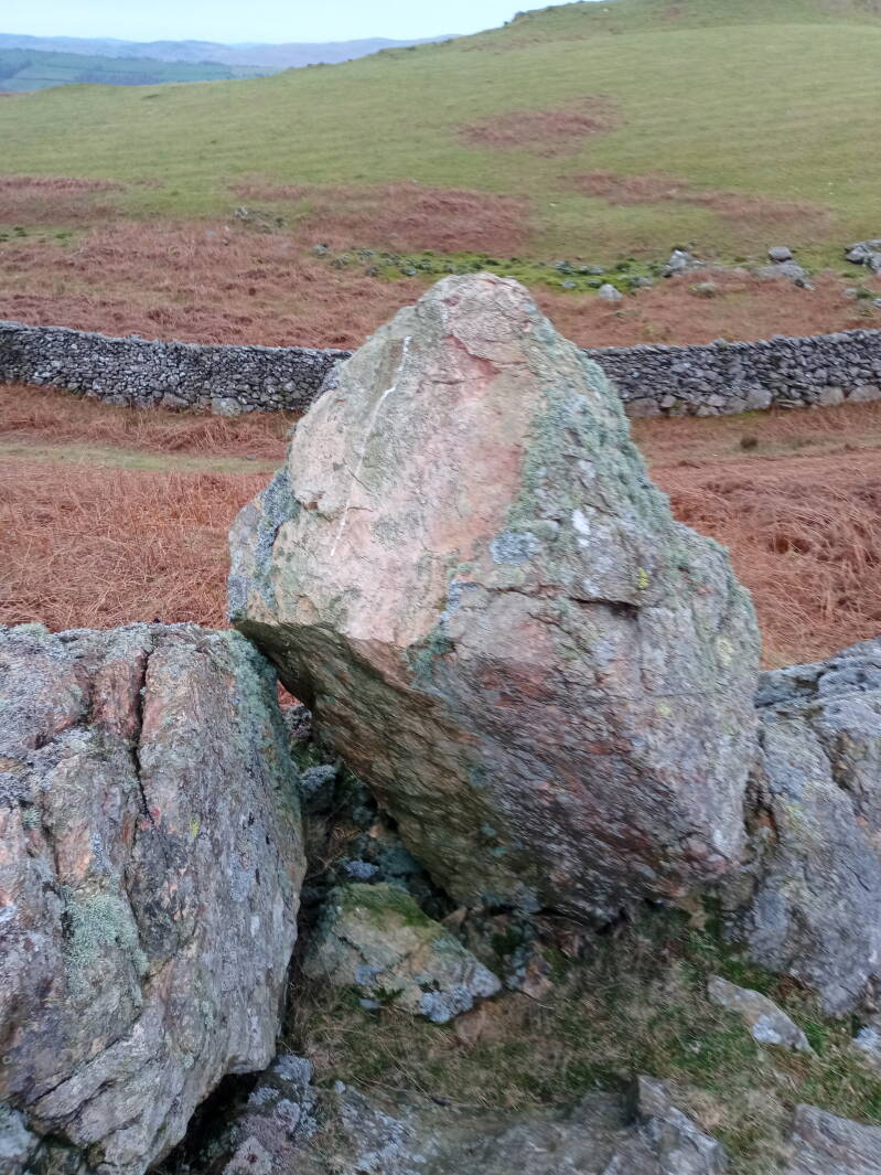
Photo below: the propped stone feature, located further south of the other areas photographed, if my memory serves me correctly, and located close to the farm track. The elongated-skull shape to the stone is not especially visible from this angle, but the fact that it is propped against the stone to the left of it can clearly be seen in the photo below. The elongated skull stone also contains unusual holes which almost look as though they come from melting, although a natural erosion process is of course more likely. Having said that, several such stones at Cumbrian megalithic sites have similar unusual "holes" in them.
I hope that this blog post was an interesting read, and it is dedicated to my family and to the ancient spirit ancestors of the Duddon Valley are surrounding areas, and to the people of this valley and surrounding areas who live there today. Speaking of Iron, there is a place called Iron Crag nearby, not far from Wormshell How, and I think it is quite possible that this place-name could relate to potentially very old mining, in some way. Please take care if visiting those Fells!
Add comment
Comments